|
|
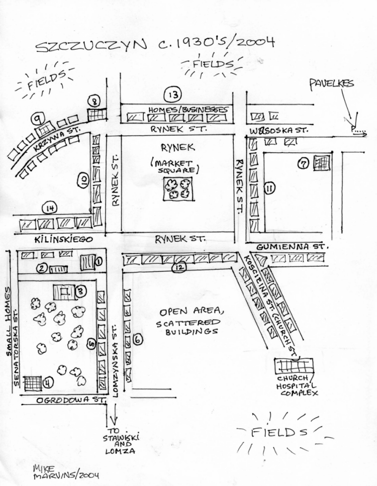
Map Legend: |
|
|
|
|
1 |
|
"New" Synagogue / Bes Midrash - destroyed |
|
2 |
|
Rabbi Jossele's home - in
existence |
|
3 |
|
Volunteer Fire House - also site of community events, plays, movies - still used |
|
4 |
|
Moshe Farberowicz flour mill - still operating |
|
5 |
|
Homes (Polish + Jewish) - Amrofel, Panush, etc. |
|
6 |
|
Homes - including Zuckerman and Sosnowski |
|
7 |
|
Large Farberowicz flour mill - abandoned |
|
8 |
|
Police - currently used |
|
9 |
|
Bibliowicz complex, center of ghetto (about 2 blocks) - street sealed with barbed wire
became ghetto in 1941 until 1942; street bombed later. See Yizkor Book. |
|
10 |
|
City Hall, courts, stores (Golding, Zemel, etc) - bombed 1944 - rebuilt |
|
11 |
|
Homes / Stores - Rosen, Rozental, Zimnowicz, etc |
|
12 |
|
Homes / Stores - Gutman (second floor was Jewish Library and meeting room) |
|
13 |
|
Homes / Businesses - Panush, Berensztejn, etc |
|
14 |
|
Larger Buildings ("Novyswiat" picture) - customs house, Szjenberg store |
|
|
|
|

 Return to
 )